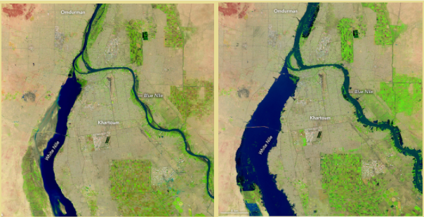
Rapid transformation processes occur in low- and middle-income countries (LMICs), impacting natural habitats, rural, peri-urban and urban areas. In particular, LMICs have accelerated economic growth combined with rapid conversion of natural habitats. The newly emerging human settlements exhibit varying degrees of inequalities in terms of access to basic infrastructure and essential services. Moreover, local environmental conditions can have severe impacts on living conditions and health outcomes. To adequately monitor these transformation processes, timely and spatially disaggregated data are essential but often not available. Earth Observation (EO) data can provide immense opportunities for monitoring these transformations, but several challenges, pertaining to their use, need to be tackled.

The EARSeL SIG on Developing Countries has been founded to bring together scientists, stakeholders, local and international organisations to support sustainable development in developing countries. It aims to provide methodological and application pathways in support of local and national information needs and specifically, supporting the monitoring of the 17 Sustainable Development Goals (SDGs).To achieve these tasks,, the SIG is open to all kinds of Earth Observation-based applications and methodological innovations that are set in these regions. In particular, we welcome:
The SIG on Developing Countries organises regular workshops on an (bi)annual basis. The workshops are organised with invited oral presentations and posters, with plenty of time for discussions and exchange. Our next Workshop (8th) will take between the 26th – 29th of May 2025 in Prague, Czech Republic within the frame of the 44th EARSeL Symposium. The SIG thematic workshop is titled “Earth Observation of the Global South” and will allow researchers to exchange on state-of-the-art EO methods to analyse transformation processes in the Global South (e.g., environmental risk, hazards, urbanisation, demographic and socio-economic conditions, conservation, agriculture), while enabling their integration for evidence-based policy making (e.g., SDGs). More information will soon be posted at the Symposium website under the “Workshops” section.
Past events:
6th Workshop on the Global South – 41st EARSeL Symposium in Pafos, Cyprus 2022
7th Workshop on the Global South – 43rd EARSeL Symposium in Manchester, UK 2024
Remote Sensing for Slum Mapping and Characterization in sub-Saharan African Cities (SLUMAP)
Group on Earth Observations (GEO)
Integrated Deprived Area Mapping System (IDEAMAPS)
The Earth Observations Toolkit for Sustainable Cities and Human Settlements

Monika Kuffer, Dr
Faculty of Geo-Information Science and Earth Observation (ITC) of the University of Twente
Department Urban and Regional Planning and Geo-information Management
Phone : +31 (0)53 4874301
Email: m.kuffer@utwente.nl
Website: https://research.utwente.nl/en/persons/monika-kuffer
Stefanos Georganos, Dr
Karlstad University, Geomatics, Sweden
Website: https://www.kau.se/personal/stefanos-georganos
Email: stefanos.georganos@kau.se
